Geo.I.Tech Systems, an organization of the best and brightest Consultants in land management and spatially enabled Informatics.

Chief Executive Officer: Fraternity. T. Makande
+7(952)413-45-80
MSc Land Information Systems and Administration, Southern Federal University, Russian Federation.
Land Surveyor-In-Training, Zimbabwe since 2015.
BSc Hons. Geoinformatics and Surveying Engineering, University of Zimbabwe.
Forte: Land Management, Land Surveying, GIS & WebGIS, Innovation.
Geomatics Consultant: Innocent Murwira
+263-774-762-715
Freelance Engineering Surveyor, Zimbabwe & Namibia since 2017.
Post graduate Geomatics trainee, Zimbabwe since 2015.
BSc Survey and Geomatics, Midlands State University, Zimbabwe
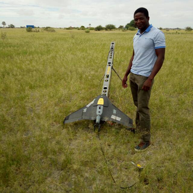
Forte: Setting out, UAV surveys, GIS .

General Manager: Tapiwa Nyakwenga
+263-778-706-944
Master of Arts In Development Studies, Midlands State University, Zimbabwe
BSc Agricultural Economics and Development, Midlands State University, Zimbabwe
Freelance Survey Assistant, Zimbabwe since 2016
Forte: Precision agriculture, Land Economics.

GIS Consultant: Last Mufoya
GIS officer at Medicine San Frontiers, since 2017.
BSc Hons. Geoinformatics and Surveying Engineering, University of Zimbabwe.
Forte: Crowd Sourcing GIS, Remote Sensing in Spatial Hydrology

Other staff
Shingai Simba : Survey Assistant.
Jonathan Jiri : Marketing Assistant.
Secretary, Data Analyst: Allen Tsenesa
+263-774-035-524
Postgraduate Statistical analysis trainee, Zimbabwe since 2018.
BSc Hons. Mathematics & Statistics, University of Zimbabwe.
Data clerk at Zimbabwe Forestry Commision, Mutare, 2011-2012.
Forte: Statistical Modeling.

Affiliate Organizations
Build-fast, Zimbabwe: For geotechnical Surveys and civil works
MD Geomatics Consultants: For Cadastral Surveys & Real Estate agency
MaKums Town Planning Consultancy: Town planning
Explore a taste of the evergrowing portfolio of innovative solutions profered by Geo.I.Tech Systems. We await to add yours to this glorious list.
GEOMATICS PROJECTS
Portion of Road of Avondale Township
Location: Salisbury district, Zimbabwe
Length: approx 350 m
Purpose: Topo survey for road designs
Date: August 2018
Client: Blue Lagoon Residents Association
Total station survey: Topcon set.
Stand 2907 Kambuzuma Township of Kambuzuma East
Location: Salisbury district, Zimbabwe
Size: approx 1 Ha
Purpose: Setting out curvy driveways and associated works
Date: September 2017
Client: Gulf Energy Service Station
Total station survey: Topcon set.
Stand 2907 Kambuzuma Township of Kambuzuma East
Location: Salisbury district, Zimbabwe
Size: approx 1 Ha
Purpose: Topo survey for engineering designs
Date: August 2017
Client: Gulf Energy Service Station
Total station survey: Topcon set.
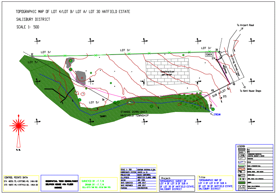
Lot 4 of Lot B of Lot A of Lot 30 Hatfield Estate
Location: Salisbury district, Zimbabwe
Size: 2000 sqm
Purpose: Topo survey for engineering purpose
Date: June 2017
Client: Build-fast, Zimbabwe
Total station survey: Topcon set.
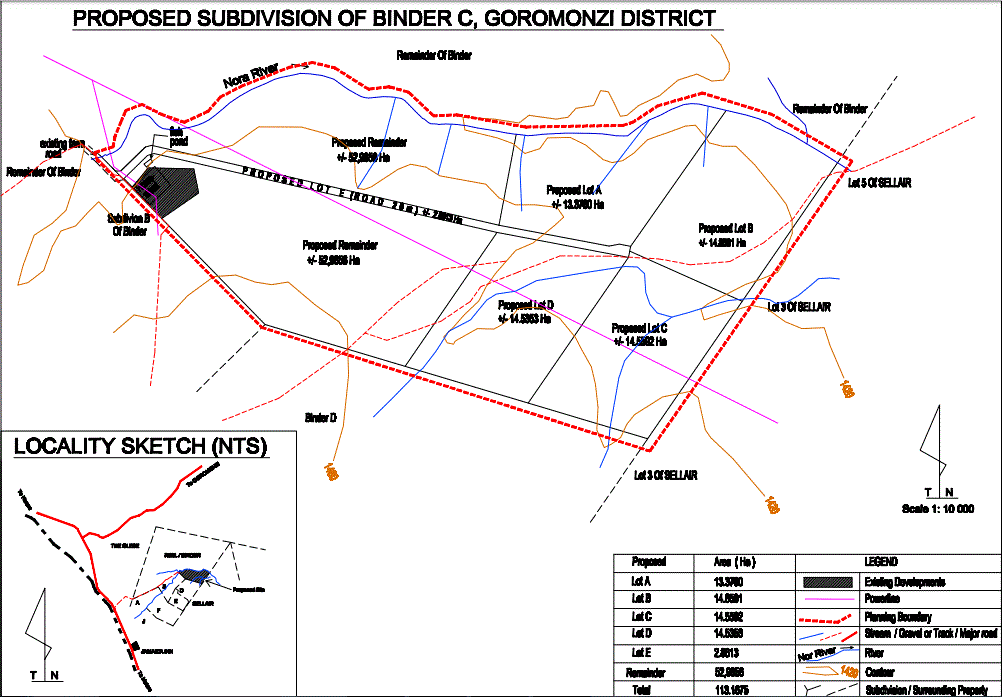
Subdivion C portion of Binder farm
Location: Goromonzi district, Zimbabwe
Size: approx 110 Ha
Purpose: Topo survey for subdivision planning
Date: December 2016
Client: MaKums Town Planning Consultancy
GNSS survey with Trimble R4-3 GPS set.
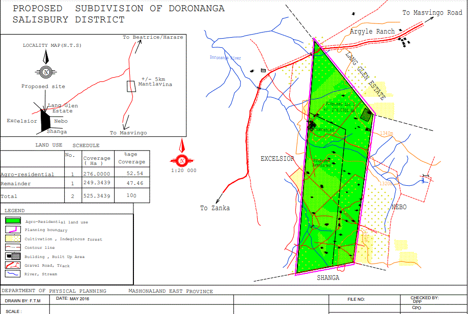
Lot 1 of Doronanga
Location: Salisbury district, Zimbabwe
Size: approx 550 Ha
Purpose: Topo survey for subdivision planning
Date: June 2016
Client: MaKums Town Planning Consultancy
GNSS survey with Leica GPS set.
Website and Software Development Studio Projects
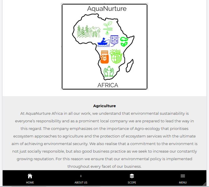
AquaNurture Africa website Development
Services: responsive design, hosting, professional email, SSL certificates, installation on Content Delivery Network, web administration, Logo design
Purpose: Company website
Date: September 2019
Client: AquaNurture Africa (PVT) LTD
Website: https://www.aquanurtureafrica.org
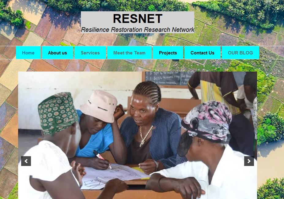
Resilience Restoration Research Network website Development
Services: responsive design, hosting, professional email, SSL certificates, installation on Content Delivery Network, web administration, blog
Purpose: Research network website
Date: August 2019
Client: Resilience Restoration Research Network (PVT) LTD
Website: https://www.resnet.co.zw
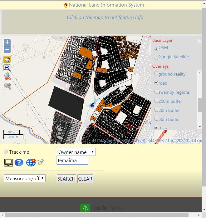
Saturday Retreat Land Information System Development
Services: Conceptual project design, 3 tier WebGIS design, Spatial Database design, Geoserver GIS server configuration, Geolocation services, website responsive design, Geoserver hosting, PostgreSQL hosting, website hosting, SSL certificates configuration, installation on Content Delivery Network, web administration, realtime chat
Purpose: WebGIS, Land Information System
Date: July 2019
Client: Zelonaya Informatics (PVT) LTD trading as GeoITech Systems
Website: https://gits.co.zw:8443/satret/